Iceland is highly prepared
Iceland is no stranger to volcanic activity and experiences an average volcanic event every five years. Icelandic authorities and the public are highly prepared for such events, and Iceland has one of the world’s most effective volcanic preparedness measures. Iceland’s geoscientists possess vast experience in dealing with volcanic activities. They constantly monitor the country’s volcanoes and provide real-time updates to the authorities, allowing them to make informed decisions and take necessary precautions.
Furthermore, Iceland has a well-developed emergency response system for volcanic eruptions. This includes evacuation plans, shelters for displaced individuals, and communication strategies to inform the public about potential risks and safety measures. The government also conducts regular drills and simulations to ensure all involved parties know their roles and responsibilities during an eruption.
Iceland is prepared for volcanic activity and highly equipped to handle other natural disasters such as earthquakes, avalanches, and storms. The country has strict building codes and infrastructure regulations to withstand these events.
Ongoing Land Uplift and Magma Accumulation Under Svartsengi
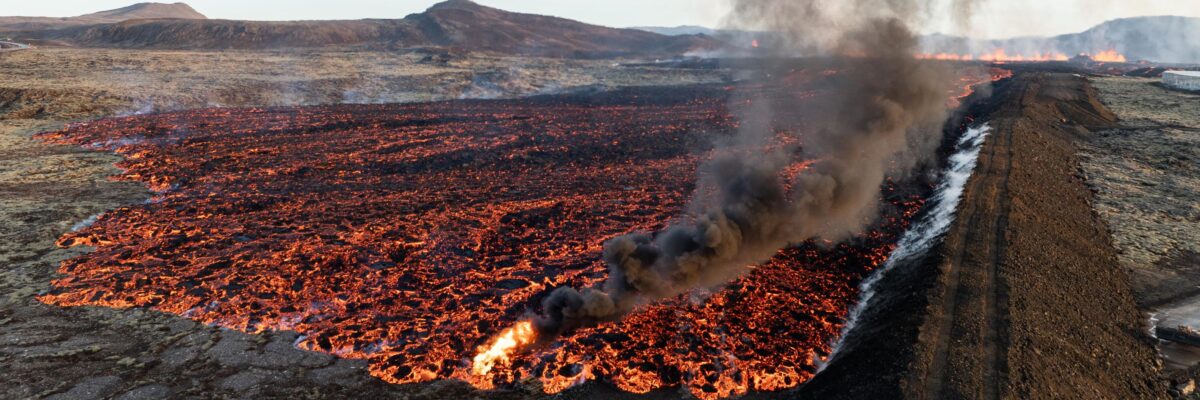
There is no ongoing eruption in Iceland, but there is an increased possibility of an eruption in the Reykjanes Peninsula area. The town of Grindavík is open for visitors. However, it has been greatly affected by earthquakes and volcanic activity. Affected areas have been fenced off. Do note that hiking outside areas marked „safe“ is considered dangerous due to unmapped crevasses.
Land uplift and magma accumulation beneath Svartsengi continue, though the pace has slowed slightly in recent weeks. As magma continues to accumulate, the likelihood of another eruption increases. It is uncertain whether significant seismic activity will occur before the next eruption. Seismic activity in Sundhnúksgígaröðin has been relatively steady in February, with around five earthquakes per day. More detailed information is available at the Icelandic Meteorological Office.
In the event of an eruption, an alarm will be sounded in the area to signal evacuation. Please note the nearest and quickest way out of town. Escape routes are marked. Scientists state that eruptions might occur without warning. Therefore, it is important to stay informed and follow all instructions given by authorities.
In addition to the alarm system, other measures are in place to help protect residents during an eruption. These include a detailed emergency evacuation plan, designated safe zones, and emergency shelters.
The emergency evacuation plan outlines the specific routes and locations to follow in case of an eruption. These routes have been carefully planned and marked to ensure the safest and quickest escape for residents. It is crucial for everyone living in the affected area to familiarize themselves with these routes beforehand.
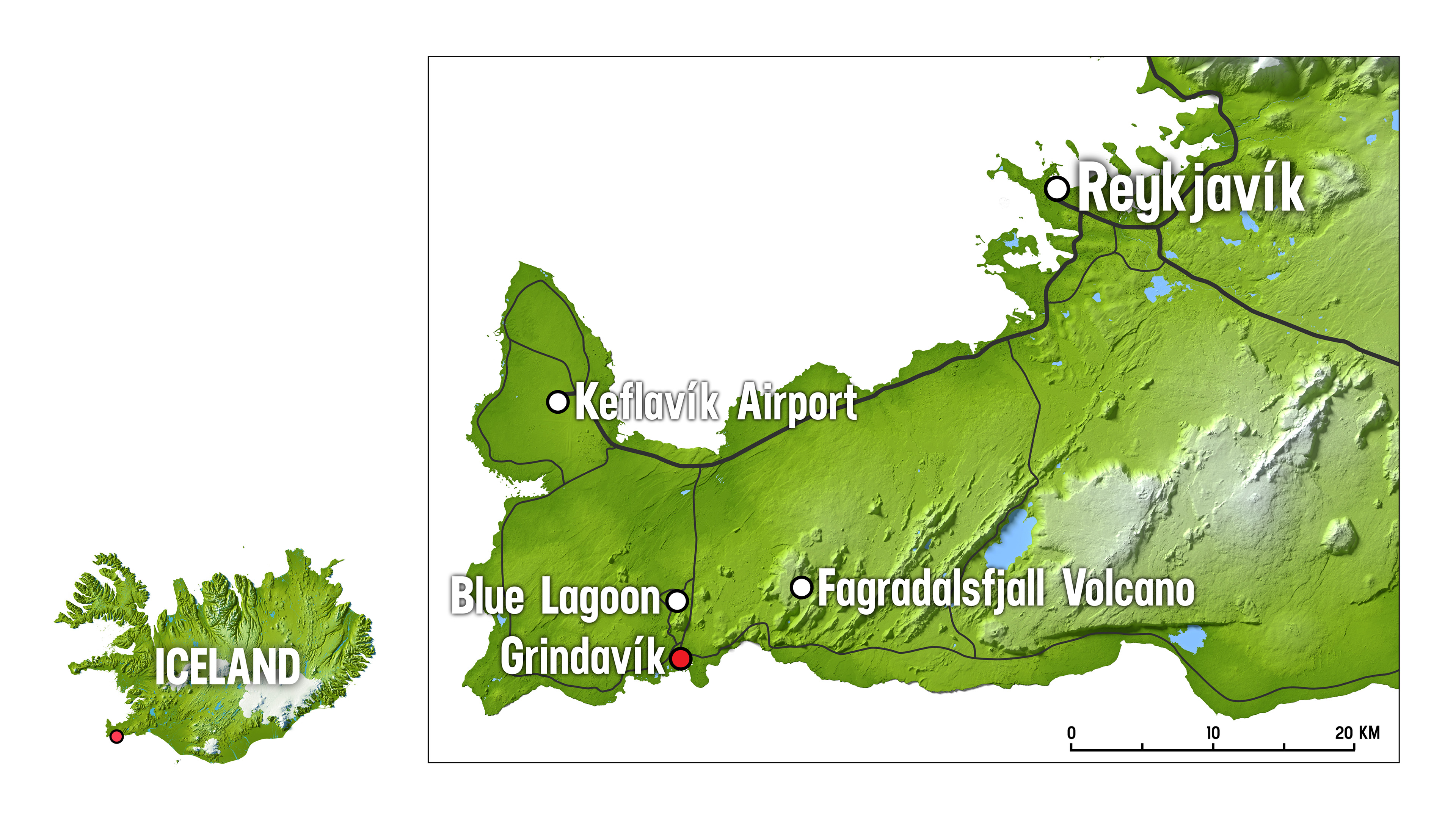
This map shows the location of Grindavík and the Blue Lagoon on the Reykjanes Peninsula.
More information:
- The Icelandic MET office: Information on the seismic activity and development of events
- The Icelandic Road Administration: Information on road conditions and closures in the Reykjanes region
- Safetravel: Updates on safety for travellers in Iceland
- The Icelandic National Broadcasting Service: News coverage
- Visit Reykjanes: Updates from the region
- Visit Iceland – www.visiticeland.is
- Isavia – flight to and from Iceland
- The Icelandic Road Administration: Information on road conditions and closures in the Reykjanes region.
- www.government.is/press for media inquiries
Good to know:
Updated news for travellers can be found here at the Iceland Tourist Board website and www.visiticeland.com